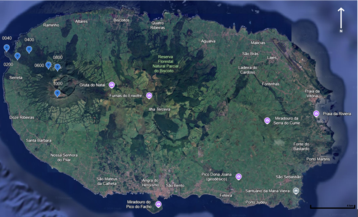
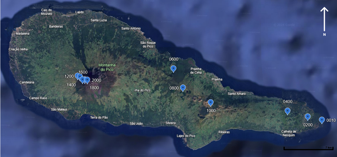
Our team in the Azores has started data collection! Last year they collected data from Pico (July) and Terceira (November). Permanents plots were selected and sampled for the first time in 2013 and 2012, respectively, and now resampled. On Pico, the team examined 24 plots across 12 altitudinal levels (from 0 to 2200 m a.s.l.), while on Terceira, they assessed 12 plots across 6 altitudinal levels (from 0 to 1000 m a.s.l.). Permanent plots were 10x10 (m), divided in four 25m2 subplots. The team measured:
- Percent coverage of every species in the plot
- Maximum height of the vegetation, measured in the centre of each subplot, and in the plot centre
- DBH of each tree with more than 10 cm DBH (only in plots with forests or woodlands)
- Number of seedlings and saplings in 2 m x 2 m quadrats placed at the corners of the 100 m2 plots (only in plots with forests or woodlands)
.jpg)
 (Photo Rui Elias).jpg)
 plot (Photo Rui Elias).jpg)
.jpg)